
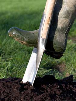
LSBUD claims that its new Google-based mapping system will help users search for underground pipes and cable that may represents a hazard to those about to dig.
New features include improved zoom capabilities to pinpoint work sites more precisely.
With Google Maps, LSBUD users can also plot their proposed work areas via satellite imagery. This helps ensure that people can see property boundaries and features, something particularly useful when operating in agricultural and rural settings, such as on the UK’s moorland, the company says.
LSBUD is also going UK wide, adding Northern Ireland to England, Scotland and Wales.
Managing director Richard Broome said: “We are taking the service we provide our users to the next level, improving accuracy by introducing the satellite-based Google Maps. This move helps operators from right across the safe digging industry, covering all sectors and the general public, to avoid the negative consequences that come from hitting an underground asset. This is chiefly the health and safety ramifications, but also the significant financial and reputational implications that come from asset strikes.”
SSE Renewables is one of the 100 LSBUD members providing asset location data to the collaborative portal. Leeanne Samuel, drawings and GIS manager, said: “LSBUD’s recent investment in Google Maps will be a great help to our customers as many of our assets are situated in remote and rural areas. Having Google satellite imagery available will enable those people requesting SSE Renewables’ asset location plans to define their site boundaries more accurately.”
Got a story? Email news@theconstructionindex.co.uk